Summer 2008
Summer 2008 |
|||||||
|
|
|||||||
ArcGIS Online Standard and Premium Services Available Soon |
|||||
|
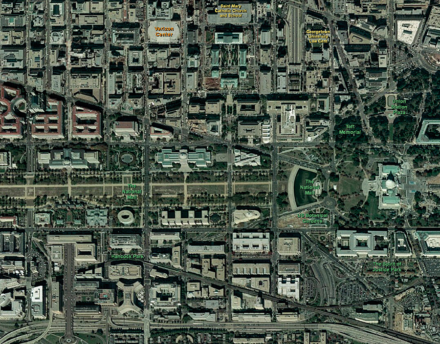
With the release of ArcGIS 9.3, the ArcGIS Online beta program is closing and ArcGIS Online standard and premium services will officially be available to all ArcGIS users. ArcGIS Online services are hosted by Esri and powered by ArcGIS Server and provide users with instant access to 2D maps and 3D globes. These Web-based services are ready to use and are cartographically rendered to support multiscale display, so ArcGIS users can quickly get started with their GIS projects without having to search for and manage high-quality basemap data.
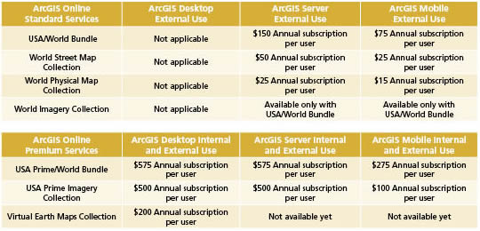
There are two types of ArcGIS Online services: standard and premium. ArcGIS Online standard services include imagery, street maps, shaded relief maps, topographic maps, political maps, and reference layers. Individual services have been combined into collections or bundles from which users can choose. For example, the USA/World Bundle includes more than 20 2D map and 3D globe services, such as world imagery, world street maps, and U.S. and world topographic maps.
ArcGIS Online standard services collections are available at no cost for internal use (personal or within a business or organization) to all ArcGIS users. ArcGIS users who would like to publish these services externally outside of their business or organization can do so by purchasing an annual subscription. For example, an organization may wish to publish a Web application using ArcGIS Server and one or more of the standard services. The annual subscription fee for external use of ArcGIS Online standard (and premium) services is based on the expected number of annual user equivalents accessing a Web application. User equivalents are determined by converting the estimated number of annual transactions required into a number of user equivalents.
ArcGIS Online premium services generally include higher-resolution or more current data than standard services. For example, the USA Prime Imagery collection consists of 500-meter-resolution imagery at small scales and 15-meter imagery at medium to large scales for the world, as well as 1-meter or better resolution color imagery for the continental United States. This collection also includes boundaries, transportation, and elevation reference layers. ArcGIS users, can evaluate ArcGIS Online premium services for 14 days before purchasing an annual subscription. However, both internal use and external use of ArcGIS Online premium services require an annual subscription. More InformationArcGIS Desktop users will be able to purchase premium services via the Esri Online Store. ArcGIS Server and ArcGIS Mobile users may contact their local Esri representative (to locate your regional office, visit www.esri.com/usa) or call Customer Service at 1-888-377-4575. For more information on ArcGIS Online services, including how to evaluate or purchase annual subscriptions, visit www.esri.com/arcgisonline. |