ArcNews Online
Fall 2010
[an error occurred while processing this directive]"Managing GIS"
A Local Government Perspective of Spatial Data Management
A column from Members of the Urban and Regional Information Systems Association
By Ron Stanfield, GIS Coordinator, Montgomery County, Alabama
![]() One goal of local government could be stated as, "To provide quality service to its citizens in the most cost-efficient manner possible." There are many things government can do to accomplish a noble goal such as this, and one is in the area of geospatial data and technologies. While using the technology to satisfy the needs of agencies and departments that employ us, we can also think about how what we do relates to other areas of local government and, together, how they relate to state and federal government. If we do it right at the local level, we can not only serve our citizens better but also help state and federal government and the private sector serve them better too. In "GIS 101," we learn that GIS is hardware/software, data, processes, and people. We also learn the benefits of collaboration and sharing data. The hardware/software tools we need are improving, and technical issues are becoming fewer. It's the people and processes of government that are the most difficult to change or improve. Local government GIS managers and practitioners are playing an important role in the evolution of spatial data management and availability.
One goal of local government could be stated as, "To provide quality service to its citizens in the most cost-efficient manner possible." There are many things government can do to accomplish a noble goal such as this, and one is in the area of geospatial data and technologies. While using the technology to satisfy the needs of agencies and departments that employ us, we can also think about how what we do relates to other areas of local government and, together, how they relate to state and federal government. If we do it right at the local level, we can not only serve our citizens better but also help state and federal government and the private sector serve them better too. In "GIS 101," we learn that GIS is hardware/software, data, processes, and people. We also learn the benefits of collaboration and sharing data. The hardware/software tools we need are improving, and technical issues are becoming fewer. It's the people and processes of government that are the most difficult to change or improve. Local government GIS managers and practitioners are playing an important role in the evolution of spatial data management and availability.
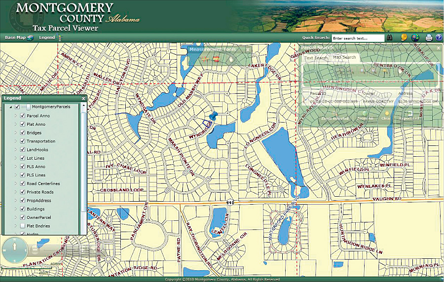
The Montgomery County, Alabama, Tax Parcel Viewer is one result of the county's evolving GIS.
About Montgomery County
Montgomery County is located in central Alabama; is 780 square miles; and has a population of approximately 225,000, with 102,000 parcels. The incorporated areas are the City of Montgomery and the Town of Pike Road.
In 1993, Montgomery County converted from a manual system of property ownership mapping to an automated system using CAD software. The Data Processing Department, as it was known then, wasn't using GIS, so we had to educate ourselves on basic IT concepts. As our technical knowledge grew, so did our desire to do more with it. Supported by an Esri partner, we converted to Esri software and coverage format around 1997 and immediately began improving our processes and products for mass property appraisal and ad valorem taxation. Since then, the system has been slowly evolving and growing in the types and number of users within county government, and it is now supported by the county's Information Systems Department.
Acting Locally
Some of the ways GIS has served as a change agent and improved local government in Montgomery are common among many jurisdictions across the country. Data sharing with other departments and the municipalities within the county enhances the return on investment for the taxpayers by increasing service capacity and keeping overall costs of data maintenance as low as possible.
Around 1997, Montgomery County completed an addressing project, converting Rural Route and P.O. Box addresses to street-style addresses. The final product was address points located on the structures and an updated Master Street Address Guide to be used in the Public Service Answering Point's (PSAP) Computer-Aided Dispatch system. Data maintenance required GPS and CAD software, and through a maintenance contract, new data had to be sent to the contractor to be converted into Esri shapefile format. However, there was a serious lag time between address creation/capture and the dispatcher's ability to find it in the mapping system.
This was an opportunity for our GIS to be a change agent by improving a process and saving the county money. In 1998, the suggestion was made to maintain the addresses within the county's GIS and establish the procedures to update the Public Service Answering Point's data. The benefits would be less time between address creation and query ability and elimination of the cost of data conversion. This was successfully implemented, and the addresses are now available to everyone through the GIS.
The evolution in providing quality service locally with spatial information was also demonstrated after the city/county Emergency Management Agency (EMA) implemented a reverse 911 system. The system was proposed to use address data from a national data provider. We offered to provide the address point and road centerline data on a consistent basis, and EMA has been able to spatially identify and warn residents of emergencies and dangers using accurate and more up-to-date address data.
Using the same data, the County Board of Education, which also governs the city and town, was able to geocode and locate 98 percent of the students, which made school assignment and bus routing more efficient.
After Census 2000 results were used to redistrict, maps were hung on the walls of the Board of Registrars and the Elections Board. They were not maps from the county's GIS but from a contractor that had used the Census Topologically Integrated Geographic Encoding and Referencing (TIGER) data. The suggestion was made to bring the resultant new political districts into the county's GIS and give users in those departments desktop access to it. Again, GIS became a change agent by giving the departments the ability to streamline the voter registration maintenance process by simply having a visualization tool that also allowed the query of an address and returned an overlay that identifies all the political districts and the voting precinct the address is within.
Helping Nationally
Although the authoritative geospatial data at the local level exists to serve the local governments, as GIS managers, we should be conscious of a bigger picture. We maintain a piece of a puzzle defined by the Federal Geographic Data Committee (FGDC) as the National Spatial Data Infrastructure (NSDI). The NSDI initiative is promoted at the national level, but support from local government has to exist for it to be as effective as possible.
The initiatives proposed by FGDC are not new, and the concepts in this article are echoes of many knowledgeable GIS practitioners. But as the landscape of regularly maintained geospatial data has been evolving, so have the options available to share it. Some programs, such as Virtual Alabama, have established partnerships with city and county governments and provide the capability to upload data on a regular basis for specific government use. But the ability to develop Web applications and publicly expose map services is quickening the evolutionary pace of current data availability. It is up to the managers of authoritative data to embrace the practice of data sharing and take it to the level envisioned years ago.
Continuous Improvement
One of the ways Montgomery County must improve its cooperation and contribution is in the area of metadata. Unfortunately for the NSDI initiative, we are not alone. But we realize that our inaction over this important aspect of the NSDI cannot continue if we are to do our part. We feel that another way to participate in the bigger picture is to embrace the FGDC standard on addressing. We will have to reconfigure some desktop applications for PSAPs and EMA, among others, but the value of the data will increase as it is being optimized and shared with state and federal government. We plan to participate in online data publishing as we strive to increase the value of all we do.
As our GIS matures, we will continue improving the data and processes "to provide quality service to our citizens in the most cost-efficient manner possible," and we will keep an eye on how we can help others do the same.
About the Author
Ron Stanfield, GISP, is a member of the Alabama Association of Assessing Officials, the International Association of Assessing Officers (IAAO), and the Urban and Regional Information Systems Association (URISA) and is on the board of directors for the Alabama chapter of URISA. He holds the Alabama Certified Mapper designation through the Alabama Department of Revenue, the Certified Mapping Specialist designation through IAAO, and the GISP certification from the GIS Certification Institute.
More Information
For more information, contact Ron Stanfield (e-mail: ronstanfield@mc-ala.org).