Fall 2008
Fall 2008 |
|||||||
|
|
|||||||
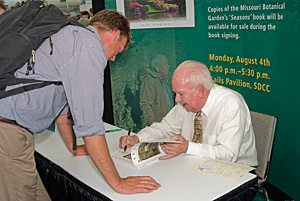
2008 Esri International User Conference Keynote Speaker
Renowned Botanist Peter H. Raven Offers Plan for the Planet |
|||||||
"Habitat destruction is the major force driving biological extinction. It is estimated that two acres of tropical forest are lost every second. The loss of Brazilian forest will reduce the richest of all habitats on earth as this century ticks along," warned Peter H. Raven, Ph.D., in his keynote address at the 2008 Esri International User Conference in San Diego, California. He spoke of the value GIS brings to understanding our world and offered a to-do list for conference attendees to engage in sustainable practices. Raven is a world-renowned botanist who taught for a decade at Stanford University. Then, in 1971, he joined the Missouri Botanical Garden (MBG), where he is the president. MBG is the oldest botanical garden in the United States and will celebrate its 150th anniversary in 2009. Addressing the gathering of approximately 14,000 GIS professionals, Raven said, "We will determine what the world will be like in the future whether we take direct action or not. Biodiversity gives form and meaning to us because our existence depends on the living world. Our species has developed in direct relationship to our ability to be able to use the plants and animals in which we have come into contact. Obviously, we could use many more types of plants if we knew what they were and understood how they might help us to extend productive agriculture in the world." GIS brings great value to the mission of understanding biodiversity and raising awareness that leads to action. It has been an important technology at MBG. During the past 10 years, staff members have been using GIS provided by Esri to help them keep track of the individual organisms in the collections. In recent years, the role of GIS has grown. MBG now has an analysis unit and GIS lab wherein scientists create predictive models for regional and global analysis. They also explore further ways of applying GIS to improve conservation, research, and education projects.
MBG's Herbarium, a collection of preserved plant specimens, contains some of the most magnificent botanical specimen records in the world among a total of six million specimens. These botanical records contain documentation collected over the centuries. With the advent of GPS devices, specimen data now gathered includes latitude and longitude points along with other digitized data. The staff has worked long hours in georeferencing nearly two million of these specimens to map their locations. GIS is used to process data that addresses issues of plant diversity all over the earth. It is used for projects in Africa, Madagascar, China, Central America, and South America. The GIS lab staff has also built an ArcIMS software-powered Web site at www.tropicos.org that allows users to dynamically map specimen collections in the organization's database. In an informative demonstration that targeted areas of South America, MBG research scientist Trisha Consiglio, Ph.D., joined Raven to explain her methodology for determining the most important factors for species distribution. She demonstrated how she is using GIS modeling to predict how species are thriving in areas where little is known. A grid density map based on known data showed relationships between a given species richness and a region's environmental factors. Consiglio described a predictive model based on regression analysis for coefficients that fit various environmental variables to reveal what is missing from the known data. The variables in the demonstration were potential evapotranspiration, topographic complexity, and precipitation, which are important for determining species distribution. By correlating these factors, scientists at the Missouri Botanical Garden were able to create a map that filled in predictive species richness in the study region of Central and South America where little floristic information exists. Climate change is also an important factor, because it affects the distribution of current suitable habitats of plant and animal species. This in turn affects species migration to these habitats. Scientists at MBG are using species distribution modeling to predict the future suitable habitats for various plant species based on climate change scenarios.
"In the future, climate change will affect the patterns of diversity we see today," noted Consiglio. "Using GIS tools to predict these changes may give us a better understanding of how that change will happen. In order to protect what we have, we need to know where it is." "This is a huge advantage in studying tropical forest information," concluded Raven. "GIS makes it possible to overlay information such as soil type, habitat, species, and other factors. People are beginning to work out how soil types interplay with elevation and rainfall. We suddenly find our knowledge of biodiversity growing at an alarming speed. In research, we use GIS to put together what is an incredibly limited amount of selected information into meaningful patterns whereby we can find the correlations. We cannot only know what we know. We must rediscover what we've already learned, and find out what we don't know." A Plan of Action to Save a PlanetSeeking active participation, Raven challenged GIS professionals by suggesting they put into practice seven resolutions:
More InformationLearn more about the Missouri Botanical Garden Library at www.mobot.org/mobot/molib. |