Fall 2008
Fall 2008 |
|||||||
|
|
|||||||
Esri's New Fleet Management Solution Helps Fleets Get Lean and Go Green
ArcLogistics 9.3 is the "GIS" in Logistics |
|||||||||
Highlights
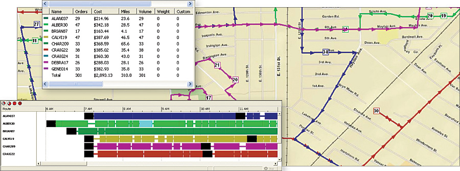
Efficient fleet management is a growing concern of businesses and local governments as they seek to optimize the performance of vehicle operations to save fuel, reduce labor and maintenance costs, and operate in a more sustainable manner. Esri's ArcLogistics 9.3, a new version of a proven product built on the ArcGIS platform, will help users improve their daily fleet operations to achieve an optimum level of performance, resulting in less fuel consumed and ultimately a smaller carbon footprint. ArcLogistics is used for building efficient routes and schedules in a multistop/multivehicle environment using variables that reflect users' operational workflows.
With ArcLogistics, organizations are able to service more customers with the same fleet, respond to same-day requests, and improve customer service satisfaction by offering tighter time windows for deliveries, pick-ups/drop-offs, and service calls. Fuel consumption is reduced because individual routes are optimized, meaning fewer miles driven, ad hoc trips, and lost drivers.
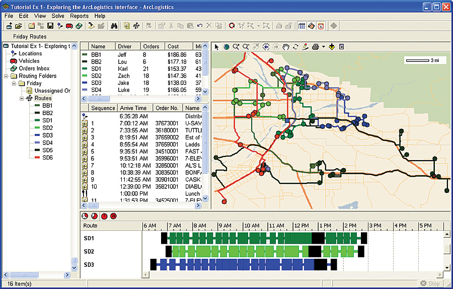
ArcLogistics 9.3 builds on the legacy of ArcLogistics Route, a product developed in the late 1990s, whose users consistently reported operational cost savings of 15 to 20 percent. The earlier ArcLogistics Route was an effective operational tool for all fleet sizes, as it was designed for non-GIS professionals to quickly create the best routes and schedules while taking into account their business rules and the driving attributes of real street networks. The new version of ArcLogistics maintains this ease of use while adding new advantages that will make it a valuable, scalable, and analytic tool for GIS professionals. Built on the ArcGIS PlatformArcLogistics uses ArcGIS Engine as the base technology, along with some ArcGIS Network Analyst components. Routing projects are now stored in a file geodatabase for virtually unlimited capacity. A network dataset is used for the routing network. Any organization that has invested in a network dataset can use it in ArcLogistics 9.3. Users Employ Their Own Network Dataset and GIS Data LayersUsers can take advantage of a more powerful and realistic street dataset for routing. ArcLogistics 9.3 consumes a network dataset that has the ability to include attributes and functionality for restrictions, impedances, barriers, and speed management.
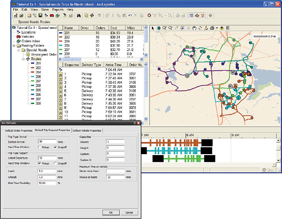
ArcLogistics 9.3 opens to an .mxd file and includes the ability to add geographic data layers and Web services. The new table of contents in the Map View allows users to alter the Map View's rendering symbology and labeling. Organizations can use and manage their own network dataset and locators in ArcLogistics 9.3, allowing easier localization and street data management. Street data can be in any Esri format that contains a network dataset, allowing regional routing in multiple continental areas. High-Quality, Up-to-Date Street Data from the World's Leading Data ProvidersFor those without their own network dataset or who wish to supplement their network dataset with commercially available street data, they can license street data from either Tele Atlas/TomTom or NAVTEQ. Both sets of data are available for Europe and North America. Paratransit Business RulesArcLogistics 9.3 includes new routing rules, allowing organizations involved in paratransit operations to create efficient routes while honoring specific ridership rules and vehicle capacity constraints. This functionality works out of the box and requires no additional programming. Model Existing Routes
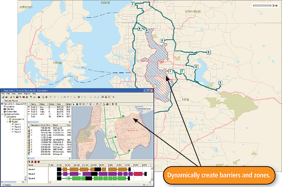
It is easy to model existing routes in their predefined sequence. Users can set a benchmark of existing routes to gain an accurate snapshot of costs involved in operating their fleet, then compare them with optimal solutions. Create Easy-to-Use ZonesArcLogistics 9.3 includes the ability to create or import geographic areas or points to use as route zones. These areas can be tied to routes as hard zones where routes only operate with them or used as gravity points so that routes tend to operate in that area. Integrates with Core ArcGIS ProductsArcLogistics 9.3 integrates easily with other Esri products. Free plug-ins to the application are available to export routing results as a network analysis layer for use in ArcGIS and ArcGIS Network Analyst, making ArcLogistics a great operational tool, as well as a data collection point for larger, enterprise GIS efforts and analysis. Make Fleets Lean and GreenIf users need to find locations and assign sequential vehicle stops considering factors such as time, cost, capacity, and productivity, then ArcLogistics will save them time and money. With ArcLogistics, users can create routes and schedules in less time while considering their business rules and processes, helping them meet commitments, use less fuel, and reduce emissions. More InformationTo learn more about ArcLogistics and download two new ArcLogistics white papers, visit www.esri.com/arclogistics. See also the ArcLogistics 9.3 poster [PDF] |