|
GIS for the Nation is a vision for how city, county, regional, state, tribal, and national governments and others can work together to collect and share high-resolution, strategic geographic data layers for the entire nation. This will provide a more consistent approach to information management and enable the integration of individual computing nodes into a "system of systems."
The primary focus is on encouraging government organizations to collaborate on GIS data collection, management, and sharing. The goal of a national GIS data model is to support this focus. This information model is illustrated in this poster [PDF-22.5 MB, 2 pages]. It is based on the key application requirements of participating organizations.
For more information, select the GIS for the Nation link at support.esri.com/datamodels.
GIS for the Nation Vision
A variety of government agencies have expressed a willingness to work together because it makes good business sense and will enrich their individual GIS capabilities. One key reason is the high cost and level of effort involved to independently build high-quality data. GIS has become mission critical and is a key part of the daily activities in many organizations. GIS users must have the information readily available when they need it. They need complete datasets that will help them achieve their mission. These organizations have communicated that geographic information should be complete, serve multiple purposes, and be easily shared.
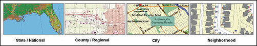
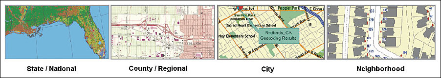
Representations at different scales. |
Twelve strategies provide the foundation of a GIS for the Nation:
- The cornerstone is a comprehensive common data model. This shared data model, based on data provided by each participant, is designed to meet the needs of local, state, and tribal governments, as well as federal agencies.
- The data model includes 14 data themes. There is a strategy for data development for each theme. Each strategy reflects key information needs of the participants. For example, the strategy for orthoimagery calls for a minimum of six-inch to one-foot resolution in urban areas (flown every two years) and one-meter resolution collected every three to five years for the whole state or country.
- Assign collection responsibility to the right organizations. In the United States, generally data should be collected locally, yet shared broadly and appropriately. Most of the strategic datasets are best collected by the local managing agencies, which can then be harvested, transformed, and shared. Local governments will collect many key datasets and organize them in regional data centers. States and national agencies will harvest these datasets into their systems for appropriate and agreed-upon reuse.
- The data model is expressed as a set of minimum guidelines. User sites would agree to collect their data consistent with these minimum guidelines so that others can reuse their shared information with confidence.
- The data model is a framework for data sharing. The schemas in each individual organization must be tailored to address individual needs, yet also must support consistent sharing between organizations.
- The data model must support a range of scales and geographic extents. Data models must be defined for use at a range of map scales in order to address a variety of problems and applications.
- The data model must reflect the needs of all participants. The design must be multipurpose. The design must be useful for many applications and must meet the varied needs of local, state, regional, tribal, and national organizations. Each user organization must be able to see their data requirements reflected as elements in the comprehensive data model.
- The design must be application driven. The design must reflect the information needs of each organization to meet their business needs.
- The design must build upon best practices. The GIS for the Nation requires a simple system that works—one that builds on what many users are already doing or need to do.
- The design must be open and interoperable and work in any GIS. The data models and designs need to be universal and work across a range of GIS systems.
- Codevelopment requires data interchange and translation procedures for moving data between organizations and systems. Data translation procedures will be critical for facilitating information flows between various organizations and their independent, site-specific schemas.
- Users can add to this framework as needed. It must be easy for users to extend this data model by adding additional data themes and by extending existing datasets.
At this point, a draft design and a series of data templates have been developed. Currently, these are being put into action and tested in a number of systems such as a GIS for the Gulf region affected by hurricanes Katrina and Rita. These efforts will be used to validate as well as to modify and improve this framework.
Organizations responsible for building spatial data infrastructures (SDIs) are emerging in many regions, countries, and continents. The GIS for the Nation is meant to assist in building application-driven SDIs. In the United States, many organizations are taking a leading role in these efforts, including the Department of Homeland Security and the Federal Emergency Management Agency, the National States Geographic Information Council, the USGS National Geospatial Programs Office, and others, as well as numerous state and local government organizations.
For further information and feedback, contact Steve Gris�, Esri (e-mail: sgrise@esri.com).
|