
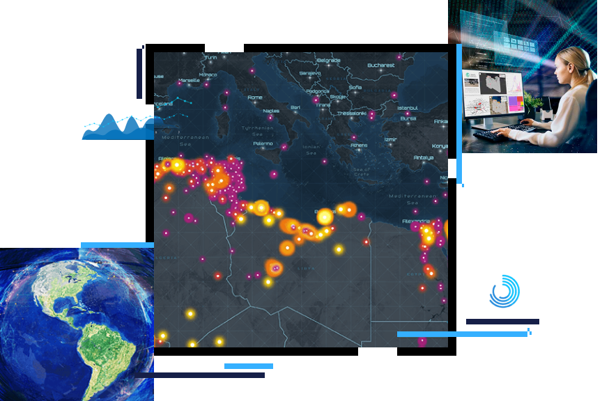
Intelligence
Use location to see patterns, connections, and relationships
GIS supports the intelligence cycle
ArcGIS helps intelligence organizations integrate information at all phases of the intelligence cycle, from collection to dissemination. Location intelligence helps integrate all types of intelligence, including the following:
- Human intelligence (HUMINT)
- Signals intelligence (SIGINT)
- Open source intelligence (OSINT)
- Geospatial intelligence (GEOINT)
- All-source intelligence
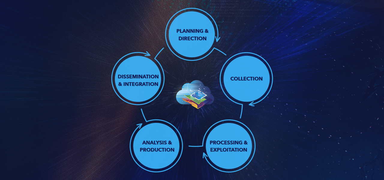
Intelligence cycles
Previous
Next
Intelligence enterprise integration
ArcGIS is designed to integrate into large, heterogenous, and constantly evolving systems. Esri partners and customers integrate ArcGIS into the systems used in intelligence organizations.

Open and interoperable
ArcGIS is an open, flexible, and interoperable platform that supports innovation. Esri supports open standards for data, services, and metadata.
Security and identity
ArcGIS uses best practices for security across our cloud, enterprise, desktop, and mobile platforms.
Cloud ready
ArcGIS is a cloud-ready system. Secure and private clouds allow intelligence organizations to modernize and consolidate IT infrastructure. ArcGIS Enterprise is ready for deployment in Amazon Web Services or Microsoft Azure clouds.
Disconnected operations
Multiple deployment patterns are supported with ArcGIS. Information can be provisioned and replicated between these environments to support disconnected, intermittent, and limited bandwidth (DIL) environments.
Esri User Conference
July 13–17, 2026 | San Diego, California

Our community
Find out how your peers are using Esri technology to achieve their goals.