New Solution for Cities to Visualize Zoning Rules, Measure Impact, and Advance Projects
Redlands, California— Esri, the global leader in location intelligence, today announced it is developing ArcGIS Urban, a solution to give urban planners and designers engaged in government, real estate, and engineering projects better city information so that they know the best places to build and develop. ArcGIS Urban will visualize zoning codes, track project life cycles, and measure the impact of projects after completion. This all-in-one system will be accessible to the professionals who plan and build cities, whether for a city planning department or a real estate development company.

The challenges faced by some of the fastest-growing US cities are due largely to a disconnect between developers’ project designs and the regulatory codes defining what can be built and where. In many cities, zoning code text is outdated, cumbersome, and confusing. The difficulty in interpreting and understanding it slows governments, stalls developers, and delays the ability of cities to meet citizens’ needs. ArcGIS Urban will help interpret these codes and make them readily available through an interactive online portal, adding efficiency to planning activities throughout the city.
“Over the last few years, we have been averaging about 80 large development projects a year, and growth at this scale requires thoughtful planning,” said Carolyn Bennett, Boston Planning & Development Agency GIS supervisor. “These new tools are putting powerful geospatial information into the hands of the city planners, providing access to a digital twin of Boston with dynamic zoning data that can be used to support important planning initiatives and streamline the design review process.”
An immersive and collaborative solution for decision-making, ArcGIS Urban will eliminate many of the delays that occur when numerous teams are involved in a large-scale development project. Planners can adjust the rules and regulations and understand the impact to a project’s structure, cost, and life cycle in real time.
“One of the most urgent concerns for cities today is ensuring a supply of new housing to meet the demands of growing populations,” said Brooks Patrick, Esri account executive. “ArcGIS Urban will offer planners and designers a common environment for sharing what is being planned and what is being built, allowing them to discuss and resolve problems around housing, transportation, and economic activity efficiently.”
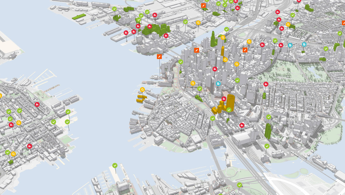
ArcGIS Urban combines real-world information with zoning rules and will put this into the hands of the practitioners, supporting neighborhood planning activities in the context of active real estate development. Using ArcGIS Urban, professionals who plan and construct new projects in cities will better understand how regulations will shape their buildings. ArcGIS Urban will provide clear, color-coded 3D models of neighborhoods that can be navigated to see exactly what these requirements are, where they are enforced, and how they will inform current construction as well as future projects, resulting in a more economically prosperous, resilient, and vibrant city.
To stay informed about Esri’s ArcGIS Urban, visit go.esri.com/arcgisurban.
# # #
Press Information:
Karen Richardson, Esri
Tel.: 914-841-3180
E-mail (press only): krichardson@esri.com
General Information: media.help@esri.com