ArcGIS Network Analyst
Use this network-based spatial analysis tool for solving complex routing problems. Accurately represent unique network requirements.

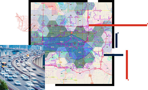

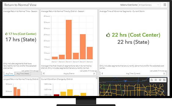
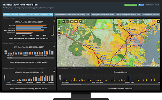
GIS in road and highway planning helps you visualize and understand the condition of your existing assets and the performance of your transportation network. It also helps you analyze needed safety improvements to determine the best mix of new projects and required maintenance activities. With location intelligence, you can strategically prioritize your investments.
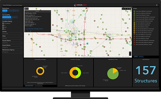

To effectively plan investments, planners must collect, analyze, and evaluate candidate projects for inclusion in agency plans. GIS provides a single process for collecting, organizing, and evaluating potential projects from multiple organizations to streamline the planning process. Bundle projects to create scenarios and optimize the mix and timing of projects to deliver the greatest value to constituents.

Effective collaboration is a hallmark of a successful transportation planning process. The ArcGIS platform enables you to build consensus across organizations. At the same time, you want to build public confidence that you have made the most strategic and cost-effective decisions regarding the public's tax dollars. GIS can help communicate the effectiveness of your road and highway plan to build confidence and greater public support–because a map can be worth a thousand words.
Explore ArcGIS Solutions and product offerings that enhance roads and highways planning.