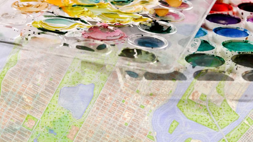
I dare to say that everyone loves watercolor. It’s beautiful to look at and it gives a warm, fuzzy feeling. For those of us without much watercolor talent, John Nelson comes to the rescue: we can apply the styles he created to our own data in ArcGIS Pro and then we can share them to ArcGIS Online as a web tile layer (disclaimer: the symbology is not supported if we publish them as a vector tile layer or as feature layer).
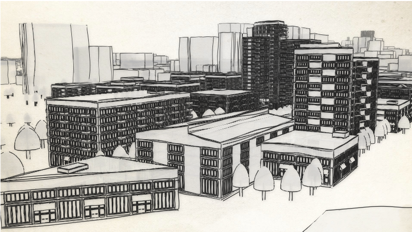
The city of Cambridge, Massachusetts publishes as open data all the data needed to create a basemap (and much more). So I loaded it in ArcGIS Pro and applied some of the watercolor styles. I modified a bit the styles, I always go for more saturated colors in 3D to compensate for the lighting that sometimes makes the basemap slightly darker.

I grouped all of the basemap layers and I published the group layer as a web tile layer. In SceneViewer I then added the buildings, the trees and the labels for the parks. Let me tell you about two small tweaks I made:
Tweak no 1: I added John Nelson’s paper texture layer (and like any good cartographer, I added it twice to make the effect even stronger) and grouped it together with the watercolor tile layer. On the watercolor layer I set the blend mode to ‘multiply’ and like this I get the “this map is painted on a paper” effect.

Tweak no 2: With drawings/watercolor we move away from realism and dive into an abstract world. My abstract world usually gets a lot of light, so I set the “virtual lighting mode” by unchecking the “Sun position by date and time” in the Daylight widget. I also disabled the shadows because they are too dark and don’t play well with the transparent trees.

With this webscene, I created a small web application that shows a possible proposal for a park in Cambridge, Massachusetts. I think such project proposals work great with this style. You can interact with the application below or explore the web application in full screen here.
Thank you to Cambridge’s GIS team for making all these awesome datasets available. And in case you make some nice basemaps using their data or use this tutorial for some watercolor web projects, I’d love to know!
Raluca


Article Discussion: