The June 2024 release for ArcGIS Experience Builder in ArcGIS Online introduces many new features to help you easily build no-code and low-code web apps and pages.
We’ve added four new widgets – Measurement, Feature Report, Building Explorer, and My Location (beta). The Measurement widget allows you to set default units of measure to calculate distances, perimeters, and areas on the map. The Feature Report widget generates reports from records collected by Survey123. The Building Explorer widget filters components of a building from a building scene layer. The My Location (beta) widget enables you to view and record your location and movement.
In addition, raster data can be used as a data source for widgets, and related records can be viewed by a new data action. Other highly anticipated enhancements include displaying features from multiple layers in the Feature Info widget, a new Overview map tool for the Map widget, and efficiently adding multiple sheets to the Table widget with one click. Lastly, you can use Google Analytics to track your app usage. Let’s explore these features.
Quick links

Measurement
Use the Measurement widget to preset preferred default units of measure in the widget’s settings. Unlike the Measure tool in the Map widget, users can immediately get measurement results in their expected units without having to click the Unit drop-down menu to select a different unit. The widget uses snapping by default . You can press and hold the Ctrl key to temporarily turn off snapping.

Feature Report
With the Feature Report widget, you can generate reports in PDF or DOCX format from records collected by Survey123 as shown below.

Keep in mind that the widget must connect to a feature layer that is associated with a Survey123 survey, and that the widget consumes credits.

To get you started, the widget settings provide sample templates. For more information about Report templates, click the Help icon in the settings as shown in the image on the left. You can also choose fields to display input features or hide these options from users for simplicity.

Building Explorer
You can use the Building Explorer widget to enhance an app that features a city digital twin. You can filter buildings by their levels, construction phases, and disciplines & categories, when available. The widget connects to a building scene layer.

The building scene layer is now supported as a data source and can be used in widgets such as Search, Table and Chart, alongside the Building Explorer widget, to view and locate building assets.

My Location (beta)
When you are hiking or biking on a trail, you may want to locate and record your location and movement. The My Location (beta) widget can retrieve your device’s locations as you move and create paths from them.

In addition to longitude and latitude, you can record time, altitude, speed, orientation, and accuracy for each location as shown below. You can also choose how often the widget retrieves a new location, either in time or distance. Your location information is stored in your device’s browser. If you want to save data permanently, you can export data to a file or an ArcGIS item.

Note that compared to native apps, the accuracy of the location in the browser-based app varies based on the type of browser and device. This is a known limitation.
Image layer data source
Three types of raster data are supported –Tiled, Dynamic, and the latest Oriented image layers. In addition to the Map widget, you can now display raster data in other widgets. For instance, you can use the Timeline widget to view temporal image data, like this map of the airport growth in Dubai.

As a new addition to the ArcGIS system, Oriented image layers work with widgets like Map, Image and Table. In the example below, clicking a point on the map updates the image.

However, the Oriented imagery layer does not yet work with the Oriented Imagery widget in Experience Builder. For more information about Oriented Imagery, check out this blog post.
View related records
The ability to view related records is critical to organizations with complex data. Using the new Related data action, you can now view related records in the pop-up and with widgets such as Table, Feature Info, Select, Query, List, and more.

Related records honor the pop-up configuration set in Map Viewer. If you have fields configured with Arcade in the pop-up, these fields currently do not display when accessing related records using the Related data action. This is a known limitation as Experience Builder does not yet support Arcade.
In the Data pane, you can explore relationships between related feature layers or feature tables. In the example below, the Trees feature layer is related to both Inspections and Species tables. Expanding each table displays more related information.

Google Analytics
You can now track your app usage with Google Analytics. This option is available under Privacy on the General tab. You may also configure a cookie banner to prompt the user for their consent to collecting information about their interaction with with the app.

Currently, only the number of page views can be tracked. If your app has multiple pages, you will get the number of views for each page. If your app has only one page, the number of page views is equal to that of app views.
Enhancements
Map
You can display the new Overview map from the Map widget, and pre-configure the pop-up display position on the map.

Table
As an improved configuration experience, you can now batch add all the layers from a map, a service, or a group layer to the Table widget, with just one click.

Feature Info
Previously, unlike the pop-up, the Feature Info widget could only show features from a single feature layer. Now, it can show features from multiple layers and allows you to choose which layers you’d like to show. The example below has three layers in the widget – Country, Municipality, and Neighborhood. Click each layer to see selected feature information.

Currently, you must add layers to the widget one by one. In the next release, we plan to add the batch adding capability like we did with the Table widget above.
Legend
When there are many layers in the map, it would be helpful if the user only sees the legend from layers that are visible within the current map extent. The new Legend mode enables you to do so.

Near Me
More enhancements are added to the Near Me widget, including the ability to choose which fields to be exported. Additionally, as shown below, you can create multi-level grouping in the Proximity analysis, and use the new Plan Route action to get directions with stops when there is a Directions widget in the app.

Chart
More functionality from Web AppBuilder are added to the Chart widget for parity, including a Display range slider on the X axis and the new Gauge chart type.


Bookmark
As you migrate 3D apps from Web AppBuilder, you can prevent fuzzy or distorted bookmarks (slides) images by adjusting the image size in Slide1, Slide2, and Slide3 simple templates. You can also hide the bookmark name or set a background color of the name card.

Analysis
You can set selected features as Analysis input to run tools from the Analysis widget. In the example below, we use the data action on the Map widget pop-up to run the analysis tools. You can also run ArcGIS Notebooks web tools in the Analysis widget without coding. See this blog post for more information.

Edit
You can re-order the editable layers in the widget settings for their appearance at runtime. Under the General section. you can also choose which capabilities are available to users. The new Runtime data editing option allows users to edit layers added by the Add Data widget via URL and Item.

Button
In addition to the Sidebar widget, the Button click message action can now target the Widget Controller widget, meaning you can open widgets in the controller by clicking a button.

Search
As in Web AppBuilder, you can now find a place using coordinates and the WKID. The supported format is X, Y: WKID. In this case, 5367 is the WKID.

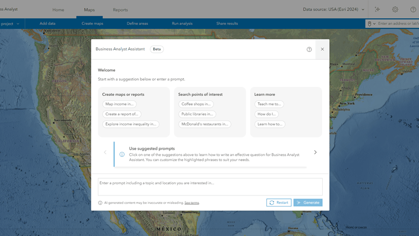
Business Analyst
You can now publicly share an app with the Business Analyst widget by authorizing access to the GeoEnrichment service with your subscription. The credits consumed by the widget are counted toward your organization’s credit total.

Tab template
To help migrate your apps, the new Tab template is added to the Web AppBuilder Classic templates category. It looks and behaves like the Tab theme in Web AppBuilder. You can customize the width of the header and footer, and the width of the Views Navigation widget where you open the widget.

Lastly, the Web AppBuilder and Experience Builder functionality matrix document has been updated in the community. Information about functionality matrix for each widget is available here.
For more information, see What’s new in Experience Builder. Please reach out to experiencebuilder@esri.com with questions.
Thank you,
The ArcGIS Experience Builder Team
Subscribe to our newsletter to receive the latest ArcGIS Experience Builder updates, news, and content.


Article Discussion: