3D GIS offers a dynamic and realistic representation of the world around us. From detailed visualizations of building projects and landscape simulations, to managing underground or water utilities, 3D GIS brings an unprecedented level of detail and context to our understanding of spatial data.
This post breaks down how to work with 3D GIS data into 4 topic areas: How to manage, visualize, analyze, and extend it with immersive experiences. We’ve put together a specific custom agenda for each area to help you quickly identify sessions that are most relevant to you.
Recommended sessions
Whether you’re just starting out with 3D GIS or looking to refine your skills with advanced applications, this year’s Esri User Conference is the perfect opportunity to stay ahead with the latest trends. Our goal is to equip you with actionable insights and techniques that you can take back and apply directly to your projects.
3D Data management
Manage 3D models and data at scale
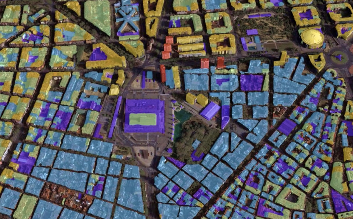
Designed to manage vast volumes of data, including 3D, ArcGIS provides a comprehensive geospatial platform that enables teams to create, organize, store, retrieve, and maintain 3D content. With support for industry-standard and open 3D formats, such as 3D Tiles and Industry Foundation Classes (IFC), ArcGIS also integrates with other systems like Autodesk Construction Cloud for computer aided-design (CAD) and building information modeling (BIM) data.
Discover the custom agenda for 3D data management sessions covering topics like authoring 3D scenes, editing 3D layers, and much more. For sessions on lidar, point clouds, and 3D meshes, check out the custom agenda for imagery.
For professionals working with 3D BIM and CAD data in ArcGIS, here’s a custom agenda for GIS, BIM & CAD sessions designed just for you.
3D Visualization
Enhance understanding and collaboration
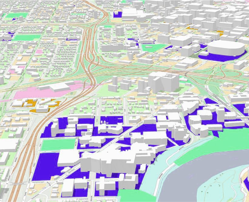
3D visualizations with ArcGIS turn spatial data into realistic representations, enhancing communication and collaboration in areas like emergency management, energy, and urban planning. These visualizations offer dynamic views and interactive graphics for deeper insights and real-world simulations, optimizing resources and reducing risks.
New to working with 3D visualizations? Check out sessions related to ArcGIS Earth and ArcGIS Scene Viewer for easy-to-use, immersive 3D experiences. For more advanced visualization techniques, explore sessions for using visual effects, such as illumination, texturing, and visualizing volumetric and subsurface data.
View the custom agenda for a complete list of sessions recommended for learning more about 3D visualization sessions.
3D Analysis
Foster informed decision making with advanced 3D analysis
3D analysis simplifies the understanding of complex scenarios and interactions. ArcGIS offers advanced 3D analysis tools that facilitate detailed spatial analysis, reveal hidden patterns, and deliver comprehensive geospatial insights.
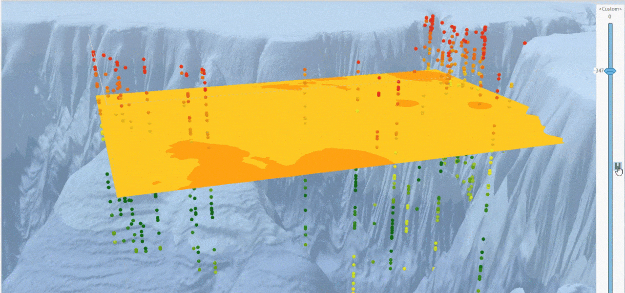
Our 3D analysis capabilities benefit professionals across government, utilities, defense, and more, by empowering faster and smarter data-driven decisions. Explore our 3D Analysis sessions to learn more.
3D Immersive Experience
Analyze and explore spatial data through interactive experiences
Extended Reality (XR) is a term that captures all the immersive technologies out there, including Virtual Reality (VR) and Augmented Reality (AR). It’s all about blending the digital and real worlds in various ways, from completely virtual environments to overlays of information on our everyday reality. ArcGIS leverages these XR technologies by offering advanced 3D capabilities and integrations, enabling you to inteact with with data in virtual or augmented reality environments.

To learn more about XR and the possibilities it offers for immersive experiences, check out the custom agenda for recommended sessions and Special Interest Groups (SIGs). These gatherings are fantastic for diving deep into the world of XR. You’ll have the chance to learn from experts, explore new trends, and see firsthand how VR and AR are being used in various fields.
3D GIS at the Expo Showcase
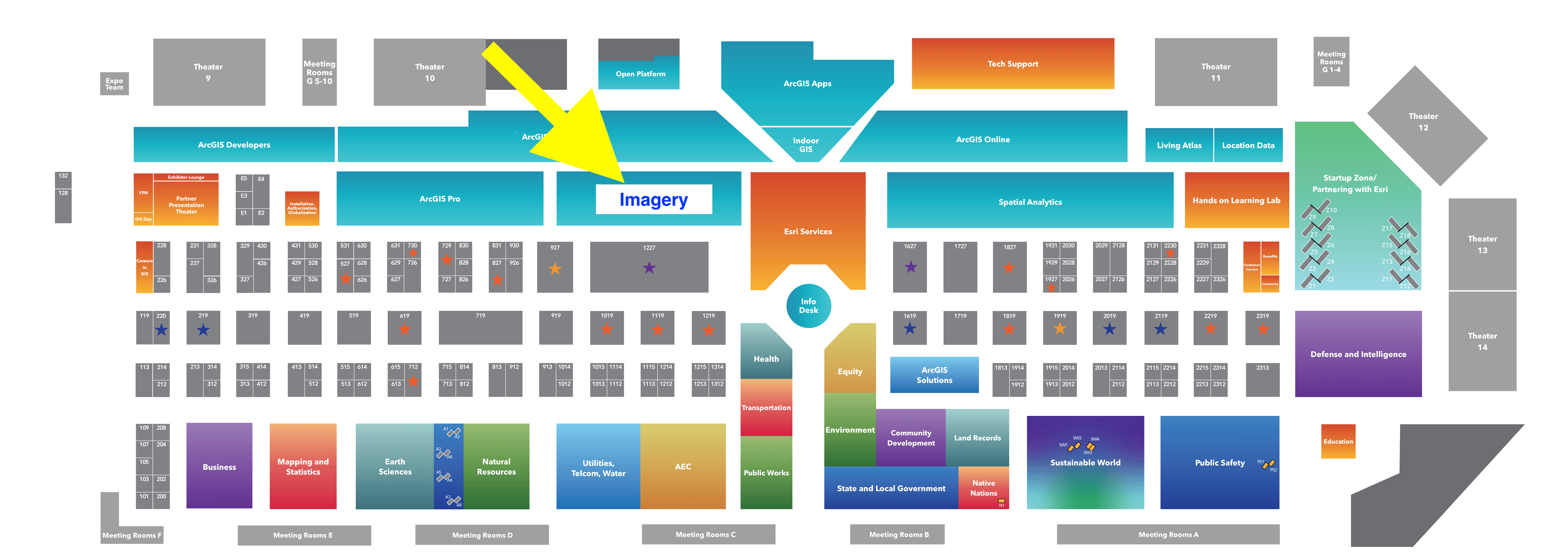
If you’re interested in exploring 3D GIS capabilities, have questions, or simply want to see the latest innovations in action, make sure to visit the 3D GIS booth, conveniently located in the Imagery area of the showcase. This is a great chance to engage with experts an get insights into new trends.
For an interactive map of the showcase, see the Esri UC Event Map.
Expo Hours:
Tuesday, July 16: 9:00 a.m. – 6:00 p.m.
Wednesday, July 17: 9:00 a.m. – 6:00 p.m.
Thursday, July 28: 9:00 a.m. – 4:00 p.m.


Article Discussion: