Hunger is not a global problem before it is a local one.
director of programs at FARSB
Vanesa Mercado
January 19, 2021
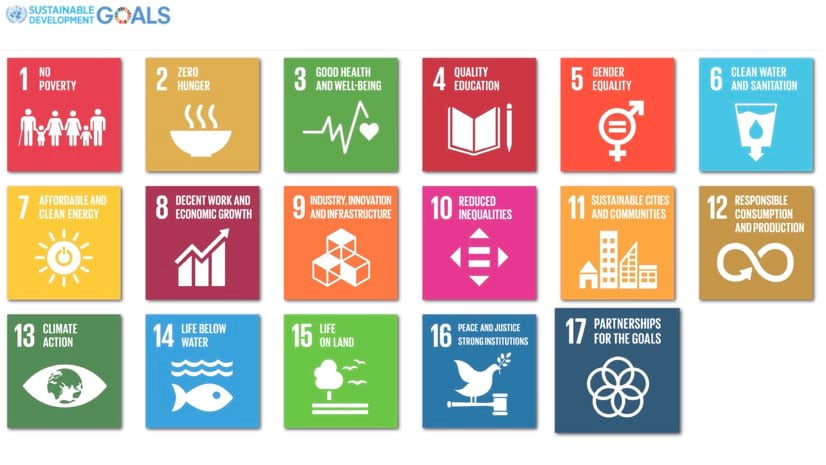
Climate change, inequality, and poverty are deep, interconnected challenges our world faces. To solve issues impacting both people and planet, the United Nations (UN) General Assembly designed the Sustainable Development Goals (SDGs). They comprise 17 objectives aimed at creating a safer, healthier, and more sustainable future worldwide by the year 2030.
To date, 193 countries have formally adopted the SDGs, demonstrating a nearly total dedication of world leaders to take the action necessary to achieve these common goals. Many are using a geographic information system (GIS) to share SDG data, stimulate policy formulation, and shape decision-making.
While the SDGs are giving national leaders a set of focused goals and GIS is providing the technology foundation, it will take hard work at local levels to achieve progress. Here we profile devoted people and organizations taking action and explore their approaches.
The community-based organization Feeding America Riverside|San Bernardino (FARSB), a member of the Feeding America national network of food banks, fights hunger in the Southern California counties of Riverside and San Bernardino. More than 800,000 people live below the poverty line in the group’s 27,000-square-mile service area. Half of those below the poverty line experience food insecurity, and 51 percent are children. FARSB works to alleviate hunger, which ties in directly with SDG 2: Zero Hunger.
Hunger is not a global problem before it is a local one.
GIS helps food banks plan food distribution, but FARSB wants to take mapping and spatial analysis much further—addressing hunger at the source. This includes closely examining causes of food insecurity such as poverty, unemployment, and poor educational opportunities. FARSB recognizes poor nutrition as an early precursor to other problems, often leading to chronic illness and increased health-care costs, which in turn lead to difficulty in securing employment, further reducing income and increasing food insecurity. Targeted approaches aim to break the cycle.
“GIS technology allows FARSB to explore overlapping layers of need and identify the ‘where.’ Where can we deploy limited resources for maximum effect? Where are the harmful patterns we can interrupt in our community?” Mercado said.
Since the onset of COVID-19, FARSB has used the GIS-based Homebound Emergency Relief Outreach (HERO) program to reach seniors and people with disabilities who are further isolated by the global pandemic. This effort proves particularly critical at a time when the pandemic has increased the local food insecurity rate by an estimated 48 percent.
FARSB uses GIS to map the locations of homebound individuals and pair them with nearby volunteer food delivery drivers. Additionally, HERO program staff use GIS to identify which distribution centers are closest to volunteers and clients. Individual maps are aggregated to provide stakeholders with an understanding of the full scope of the project and to expose concentrations of food insecurity to guide future outreach.
Founded in 1948, Direct Relief is a global humanitarian organization dedicated to improving the health outcomes of disadvantaged people and those affected by emergencies. To ensure availability of essential medical resources, the group relies on a network of more than 4,000 health-care providers in more than 120 countries.
In support of SDG 3: Good Health and Well-Being, Direct Relief equips health professionals with lifesaving medical supplies to care for the world’s most vulnerable people. A particular focus, maternal and child health, seeks to protect women and babies through critical periods of pregnancy and childbirth, including birth-related injuries.
ArcGIS Hub allows the team to highlight evidence-based efforts, at both a regional and global level, to collate a community of people and organizations that are helping move the needle forward.
One birth-related injury, obstetric fistula—a hole in the birth canal caused by prolonged and obstructed labor—often results in a stillborn baby and leaves women isolated and stigmatized. This preventable condition was once experienced worldwide, but due to improvements in post birth health care, incident rates are lower in most places except for disadvantaged areas of Africa and Asia.
To support the United Nations’ aim of eliminating obstetric fistula by 2030, Direct Relief partnered with The Fistula Foundation to create the Global Fistula Hub. Built with ArcGIS Hub from Esri, the site provides open data, data analytics, data visualizations, and upcoming industry events, as well as a venue for connection and collaboration.
“We want to promote evidence-based maternal child health-care practices and feature the work being done by the global community to remove the threat of obstetric fistula for every woman, everywhere,” White said.
To drive the use of modern technological and scientific advances for practical solutions, the Sustainable Development Solutions Network (SDSN) was created under the auspices of the UN in 2012. The SDSN coordinates with UN agencies, the private sector, and related organizations on various initiatives, including SDG implementation. In this role, the SDSN complements the UN’s work by calling attention to related issues.
The SDSN partnered with Esri and the National Geographic Society to create SDGs Today, a global hub site for real-time sustainable development goals and data. Policy makers, researchers, students, and the public can access the hub site for accurate, real-time spatial data on the current status of the SDGs in all participating areas. The hub site includes a portal for each of the SDGs, where users access datasets and descriptions; data visualizations; maps; and supporting resources, like online courses and lessons, to integrate the data into their own projects.
We want to train the next generation of leaders for sustainable development to help them obtain the GIS skills they need to push the SDGs forward.
One example is a dataset developed by WorldPop, an organization that specializes in mapping demographics in low- and middle-income economies. The dataset addresses SDG 3: Good Health and Well-Being by focusing on the percentage of sub-Saharan women of childbearing age who live within two hours’ travel time of a health-care facility. WorldPop provides the grid-based population data needed to calculate accurate estimates that support expanded access to health care.
SDSN, Esri, and WorldPop are part of the POPGRID Data Collaborative, a consortium that encourages innovation and cooperation to deliver accurate geo-referenced population, settlement, and infrastructure information. “To curate timely and spatially disaggregated data to move projects forward, and to help policy makers make more informed decisions for today and for the future, is not an easy task,” Rabiee said. “We can’t do it alone.”
SDSN also publishes sustainable development reports annually to assess each participating country’s SDG progress. To make these reports more accessible, staff created an ArcGIS StoryMaps story and an interactive dashboard. Site visitors can explore the map interface to learn about a particular country or SDG.
To make GIS data easier to use and understand in global SDG work, SDSN is developing an online GIS course, to be launched in 2021. This will include training sessions for SDSN members and education modules for universities so students can enhance their GIS skills. Toward that goal, SDSN is also working with Esri on the ArcGIS StoryMaps Competition for the Sustainable Development Goals. The contest encourages students and professionals to tell compelling stories using GIS tools and SDG data. Winners will be announced in early 2021.
The W.K. Kellogg Foundation (WKKF) was founded in 1930 as an independent, private foundation by breakfast cereal innovator and entrepreneur Will Keith Kellogg. WKKF works with communities to create conditions for vulnerable children so they can realize their full potential in school, work and life. While the Kellogg Foundation supports efforts across many of the SDGs, SDG 10: Reduced Inequalities, is a particular focus for the foundation.
In recent years, the United Nations Global Geospatial Information Management Secretariat (UN-GGIM), Esri, and other organizations have worked together to establish the International Geospatial Information Framework, (IGIF). The IGIF makes it much easier for countries or regions to establish a shared geospatial infrastructure to support SDG change efforts and to track progress toward the goals. This framework has been adopted and is in use in several countries, but many developing countries lack the tools and resources to support collaborative change efforts, and to track progress toward the goals.
We’re excited to be part of this global community working together on the SDGs.
WKKF hopes that this interconnected framework can ease the flow of knowledge and learning across change efforts. In that spirit, WKKF worked with local partners to implement a geospatial data hub to support communities of changemakers in the Chiapas and Campeche regions of Mexico. WKKF founder, Will Keith Kellogg, believed that cooperative planning, intelligent study, and group action are essential steps needed to create long-lasting change in communities. This fundamental “theory of change” helps to guide the work of the organization today. Through collaborative partnerships and a supporting grant, WKKF is working with Haiti, the UN, Esri, and local partners to bring this powerful, enabling infrastructure to support SDG and development priorities in Haiti.
“The boots on the ground efforts of local organizations require resources, planning, and geospatial tools, but more than anything, it requires the commitment and perseverance of steadfast individuals who are determined to create change at the community level,” Comstock said. “We are listening to changemakers – the people and organizations working together on positive change. If we put the needs of changemakers at the center of our efforts, could we help to accelerate the pace of positive change?”
The Kellogg Foundation hopes that this effort of listening to, learning from, and supporting changemakers is one way that philanthropy can support positive change, and progress toward the goals.
While working on the 17 global SDGs, staff at local organizations need resources including geospatial tools for planning, monitoring progress, and sharing information. What’s needed more than anything else to reach this safer, healthier, and more sustainable future are individuals and leaders determined to create change at the community level.
Learn more about how GIS helps countries collect, analyze and share SDG data for planning, policy, and decision-making.
February 1, 2019 |
July 27, 2020 |
August 25, 2020 |