For the second year, the Esri User Conference (Esri UC) was an entirely virtual event. Although scattered around the world, the 74,352 registered attendees from 210 countries were united in spirit. As it has for the past 41 years, the conference brought the GIS community together—sharing knowledge, achievements, and ideas.
Once again, the registered online attendance dwarfed any previous in-person attendance. Although attendees and Esri staff missed face-to-face encounters, the virtual format allowed tens of thousands to share the work of users. They could attend 153 tech workshops, interact with 181 exhibitors, and participate in 57 special interest groups (SIGs).
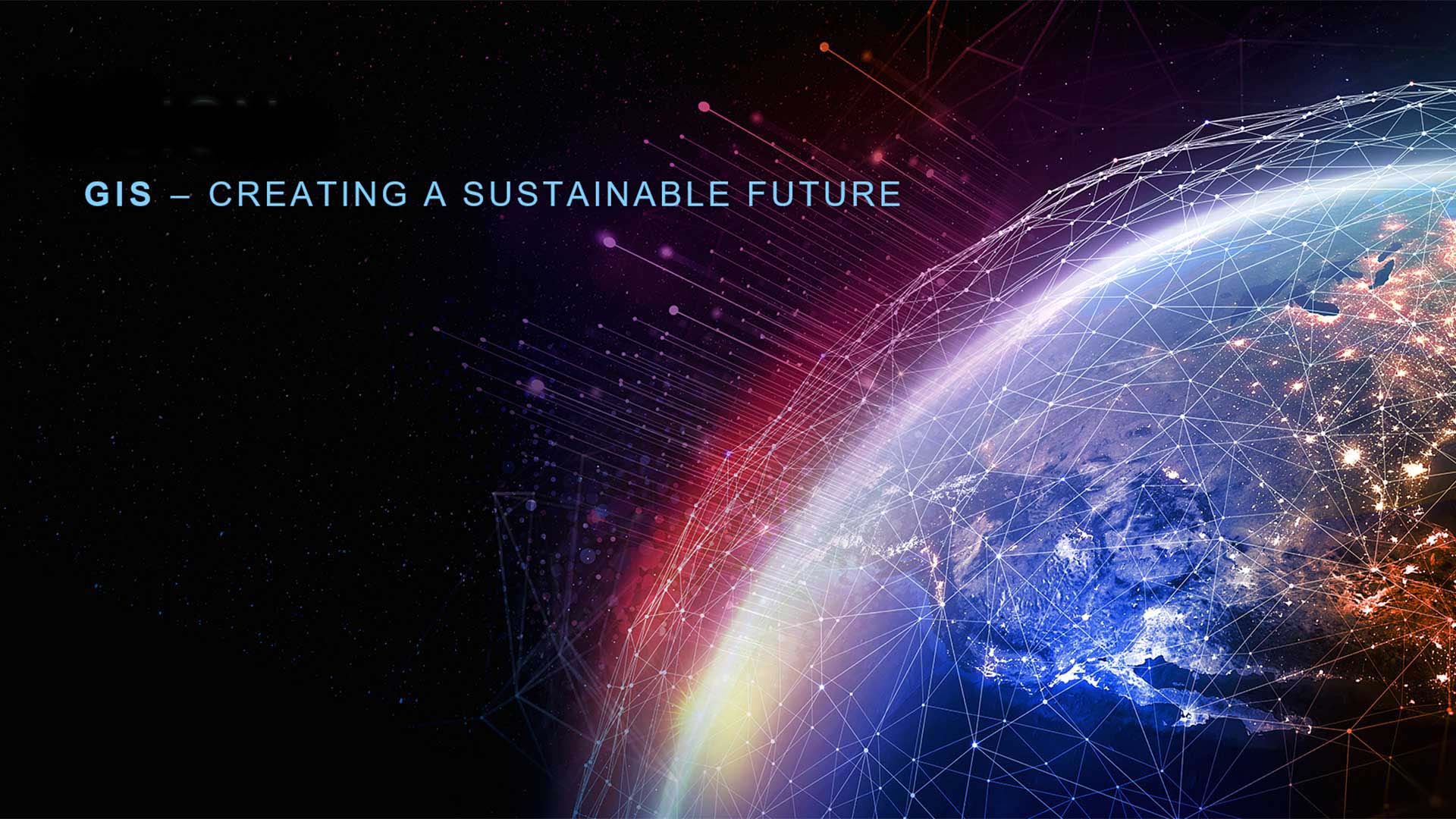
Toward a Sustainable Future
After welcoming attendees, Esri president and founder Jack Dangermond explained the conference theme, GIS—Creating a Sustainable Future. To build that future in the face of the many challenges the world currently faces will require balancing environmental, economic, and societal needs. When economic and social elements are considered together, endurability is ensured. When social and environmental elements are combined, equitability is produced. The intersection of all three elements—environmental, economic, and societal—creates sustainability.
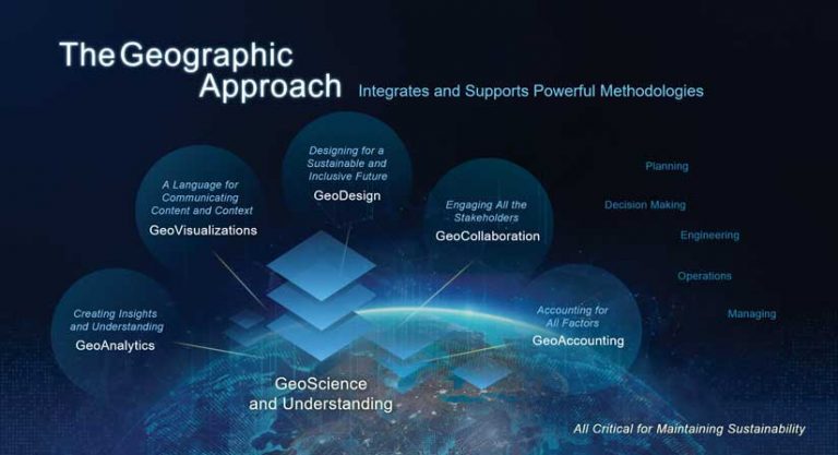
Balancing these needs requires holistic thinking on both micro and macro scales. That thinking is engendered by the geographic approach and enabled by GIS technology. As GIS becomes more interconnected, it forms a geospatial infrastructure, which supports collaboration and helps transform workflows and decision-making at many scales. “This infrastructure is creating a nervous system for sustainability,” Dangermond said.
Integration of ArcGIS with developments in mainstream IT will make previously unimaginable things possible, Dangermond noted. The ability to access massive data collections from transactional systems and imagery and link them to GIS tools will create new forms of understanding. “Big data integration is going to open our eyes; it’s going to let us see new things—relationships we never understood before.”
Highlighting Good Work
During the Plenary Session, three major awards were presented to organizations for exceptional and highly impactful work. The President’s Award went to the University of Michigan for becoming a true geospatial university through its implementation of a large-scale, campus-wide GIS that is available to faculty, staff, and students in all disciplines as a tool for research, learning, and administration.
The Louisville/Jefferson County Information Consortium (LOJIC) received the Enterprise GIS Award for identifying GIS as critical infrastructure for its organization, enabling understanding of the region and sharing data and applications across 1,300 spatial databases.
Nespresso’s dedication to ensuring quality, productivity, and social and environmental sustainability in coffee sourcing earned it the Making a Difference Award. Using GIS to bring information about farmers, landscapes, communities, and climate together has helped Nespresso create a positive impact across all aspects of its business.
Esri honored 242 individuals, groups, and institutions from across the globe with a Special Achievement in GIS (SAG) Award. Information about the work of these organizations is available at events.esri.com/conference/sagList/.
The innovative efforts of several organizations were showcased during the Plenary Session. A group from the US Department of Agriculture (USDA) Forest Service, led by Vicki Christiansen, chief of the USDA Forest Service, shared how the Forest Service uses advanced remote sensing technologies to fulfill its mission of monitoring all of America’s forests to facilitate landscape-scale stewardship.
It is working in partnership with Esri to create the next generation of information products to improve decisions today and tomorrow. Its BIGMAP uses cloud computing to accomplish raster processing and analysis of tens of trillions of pixels to produce results in just days. Its maps combine many factors and sophisticated analysis to characterize forest inventories, particularly those susceptible to western forest fires. Its datasets and services are shared via ArcGIS Online and through the FIA Geospatial Showcase, a hub site designed to empower others to create a more sustainable future.
Contributing to the presentation were Charles “Hobie” Perry, PhD, program manager for the USDA Forest Service Northern Research Station, Forest Inventory and Analysis (FIA), Barry “Ty” Wilson, PhD, research forester for the USDA Forest Service Northern Research Station FIA; and Christopher Oswalt, PhD, research forester and National Digital Portfolio lead for the USDA Forest Service Southern Research Station FIA.
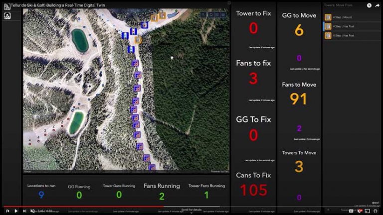
Another user presentation demonstrated the many ways Telluride Ski & Golf in southwestern Colorado uses a digital twin of the mountain to manage more than 2,500 acres for both winter and summer activities on private and forest service lands. Brandon Green, director of Snowmaking Operations and Capital, and Matt Tarkington, GIS analyst and drone operator, described how the resort uses its cloud-based geospatial infrastructure to make real-time information accessible to staff on the slopes and in the office so that quick and informed decisions can be made.
Dr. Fred J. Calef III, a Mars 2020 mapping specialist and science systems engineer from the NASA Jet Propulsion Laboratory, told how mapping was central to the success of the Perseverance rover in landing on Jezero Crater on Mars. During landing, the spacecraft used maps in real time for situational awareness and precise adjustment of its trajectory. This mission is also using maps to better understand the geology of Mars.
In addition to presentations by award winners, Esri also invitedvisionaries from diverse backgrounds to share their perspectives in keynote speeches. Paul Salopek, La June Montgomery Tabron, Dr. Enric Sala, and Wade Crowfoot provided keynote speeches during the Plenary Session.
A Walk through the Anthropocene
Salopek delivered his keynote address from Shanghai, China. He is in the eighth year of the Out of Eden Walk, a 24,000-mile journey that follows the migration route of humankind’s early ancestors from Africa to the tip of South America. He invited his audience to share what he has been seeing along the way, as “we are all walking—collectively—into a challenging 21st century.”
A writer and National Geographic Fellow, Salopek has gained a cumulatively sweeping view of this landscape from a perspective unique in the modern age—step-by-step. The idea of the walk was not just an experiment in “slow journalism,” but a strategy for seeing just how interconnected issues, events, and people are at all levels and learning valuable lessons about sustainability from the average people who are dealing with the stresses brought on by climate change and other challenges. In closing, Salopek said, “We are an amazing problem-solving species. We’ve got lots of problems—most of them created by ourselves—and we have to resolve them.” Learn more about Salopek’s odyssey through his ArcGIS StoryMaps story, My Walk through the Anthropocene, and watch a video of his presentation.
Expanding Racial Equity through Community Action
As Dangermond introduced Tabron, president and CEO of the W.K. Kellogg Foundation (WKKF), one of the largest private foundations in the United States, he noted that societal sustainability is one of the three pillars of a sustainable future.
Tabron leads the WKKF in its global mission to foster the health, welfare, and education of children; support working families; and build equitable communities. Much of the work WKKF does rests on promoting racial equity. As Tabron explained, “Racial equity is about believing that we are all human beings, we all have value, and we all deserve opportunities to thrive.”
William Keith Kellogg, who founded the Kellogg Company, started WKKF with a mission to create a place where all children can thrive. “To make sure that children thrive, you must look at issues of racial equity, community engagement, and leadership. We call those three elements our DNA. These are at the root of creating thriving communities where all children can have an opportunity,” Tabron said.
WKKF has been applying GIS to better understand systems and structures that create racial inequity, especially as those inequities have been highlighted during the COVID-19 pandemic. She noted that mapping data on COVID-19 revealed that people of color were more adversely affected and led to the exploration of the systems that produce those outcomes. “I would say the tools that you provide us through the GIS applications actually allow us to illuminate the current impact of the system and to determine what path forward might change the outcome,” said Tabron.
Internationally, WKKF; its grantee, the PVBLIC Foundation; Esri; and the United Nations have created a partnership called the SDG Data Alliance in support of the United Nations Sustainable Development Goals (SDGs), specifically SDG 10: Reduced Inequalities. This partnership will promote SDGs in 20 countries in Africa, Latin America, and the Caribbean.
In the US, WKKF is working on the Southern Communities Initiative in creating a plan to address issues related to equity in Atlanta, Georgia; Birmingham, Alabama; Memphis, Tennessee; Houston, Texas; New Orleans, Louisiana; and Charlotte, North Carolina. As part of this work, Community Action Hubs will be created to make data and maps on wealth creation, jobs, education, health, and housing available to enable better-informed decision-making.
“We hope the GIS community will help us realize this vision,” Tabron said. “We have the tools. We want the GIS community to stand up these Community Action Hubs all over the nation.” Watch Tabron’s presentation.
2021–2030: Our Last Best Chance to Protect the Ocean for the Benefit of Humanity.
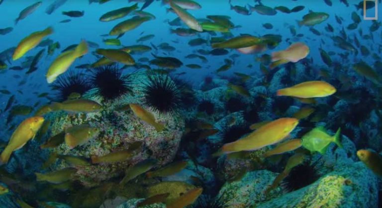
The presentation by Sala, Pristine Seas, was subtitled “Protecting the Global Ocean for Biodiversity, Food, and Climate,” which neatly summarizes the goal of his work.
Sala, a former university professor, quit academia to become a full-time conservationist as a National Geographic Explorer in Residence. He founded the National Geographic Pristine Seas team, which partners with organizations and agencies around the world to explore oceans, promote marine reserves, and conduct scientific research with the goal of protecting 30 percent of the oceans by 2030.
Although Pristine Seas has helped to create 23 of the largest marine reserves on the planet, covering an area of 6.5 million square kilometers, only 3 percent of the ocean is fully protected. To discover which areas were the most in need of protection, Sala’s team built a global database with pixels 50 kilometers by 50 kilometers that identified where species lived and their risk of extinction.
Working with Esri, the team built a tool for determining where it will be most beneficial to locate marine preserves so biodiversity can be preserved, fish populations rebuilt, and limit carbon emissions (caused by seabed disturbance) reduced. Sala emphasized the importance of this tool. “So, we can prevent the extinction of many species, the collapse of our life supersystem, and also we can help achieve the goals of the Paris climate agreement.” Watch his Esri UC presentation and view his ArcGIS StoryMaps story Protecting Our Pristine Seas.
Nature-Based Solutions in California: Combating Climate Change and Achieving 30×30
Crowfoot, secretary of the California Natural Resources Agency (CNRA), was joined by Jennifer Norris, deputy secretary for biodiversity and habitat at CNRA, in his presentation. They described how CNRA is using Esri technology to consider the state’s entire ecosystem and understand how the people, economy, and environment are interconnected. This effort will fulfill an ambitious state program to save 30 percent of the state’s lands and coastal waters by 2030 through conserving and restoring natural areas.
CNRA is working with Esri to develop an integrated suite of mapping and visualization tools that use authoritative data to display, prioritize, and track the state’s biodiversity, climate, and accessibility efforts toward achieving 30×30.
Enacting policies and action at this scale requires data-driven science and the mobilization of all stakeholders. Crowfoot noted that success will require leadership at the executive and grassroots levels. The CA Nature website (californianature.ca.gov), an open geospatial portal, helps advance community engagement goals by providing common language and understanding for conservation. View the video of Crowfoot’s address.
Extending the Reach of GIS to Solve the World’s Challenges
In addition to the presentations of keynote speakers and award winners, Esri staff demonstrated the many improvements and innovations made across ArcGIS since the Esri UC last year. ArcGIS brings many components together to work as a single system. It serves not only the GIS community, but also the mapping community, the geoanalytics community, and communities of knowledge workers outside the geospatial field. This last group uses GIS that has been embedded into widely used software, such as Microsoft Office, SAP, and Salesforce, enhancing existing specialized workflows.
The many performance enhancements and new capabilities across the ArcGIS system were discussed throughout the Plenary Session. Of note, were the substantial increase in high-quality ready-to-use content available from the ArcGIS Living Atlas of the World; image hosting and analytics in the cloud; increasing use of machine learning, deep learning, and artificial intelligence (AI) across the ArcGIS system; and the introduction of ArcGIS GeoBIM.
The new 10-meter-resolution Esri 2020 Global Land Cover layer, added just before Esri UC, exemplifies the authoritative layers and services, such as biodiversity, air quality, global river flow, and wildfire risk, which are available and let users concentrate on finding answers rather than searching for and processing data. (See “AI Enables Rapid Creation of Global Land Cover Map” in this issue.)
Imagery and remote sensing are supported by an integrated system of map and data production, visualization, exploitation, analysis, management, and dissemination. ArcGIS Image for ArcGIS Online augments these capabilities with a software as a service (SaaS) offering for hosting imagery and performing analytics in the cloud. (See “Increase the Value of Imagery in Your Organization” in this issue.)
Improvements in the application of machine learning, deep learning, and AI intelligence include ArcGIS feature extraction from imagery, new pre-training models, and better integration with the open science ecosystem.
With ArcGIS GeoBIM, GIS and BIM work side by side to coordinate critical system details to build sustainable infrastructure. ArcGIS GeoBIM unlocks knowledge in both BIM and GIS across projects and aids project coordination.
The Time Is Now
The geographic approach reveals the interconnectedness of all life on Earth and leads to the realization that people can no longer live apart from nature but must live as part of it. Dangermond emphasized that while the geographic approach is going to provide us with the science and practical means to move toward a future that is sustainable on all levels, it is not enough. It will require the commitment of GIS professionals.
“You and your work are going to be essential in providing leadership in your own organization, carrying out problem solving. These are the kinds of things you already do, but think larger—think holistically,” he said, exhorting Esri UC attendees to action.
“Personally, I feel like I’m all in. I’m going all in, and I really want to encourage you to act with urgency. These are the times where we really have to get it together and move at many different scales.”
“Applying our best science, our best technology, and our best creative thinking will clearly be necessary,” Dangermond said. “And I can’t help but know that geographic thinking is going to be essential in this. Sustainability requires that we see the world as one single ecosystem. Geography provides the science and language to do this.”
To learn about all the improvements in ArcGIS announced at Esri UC, view videos from the Plenary Session.